
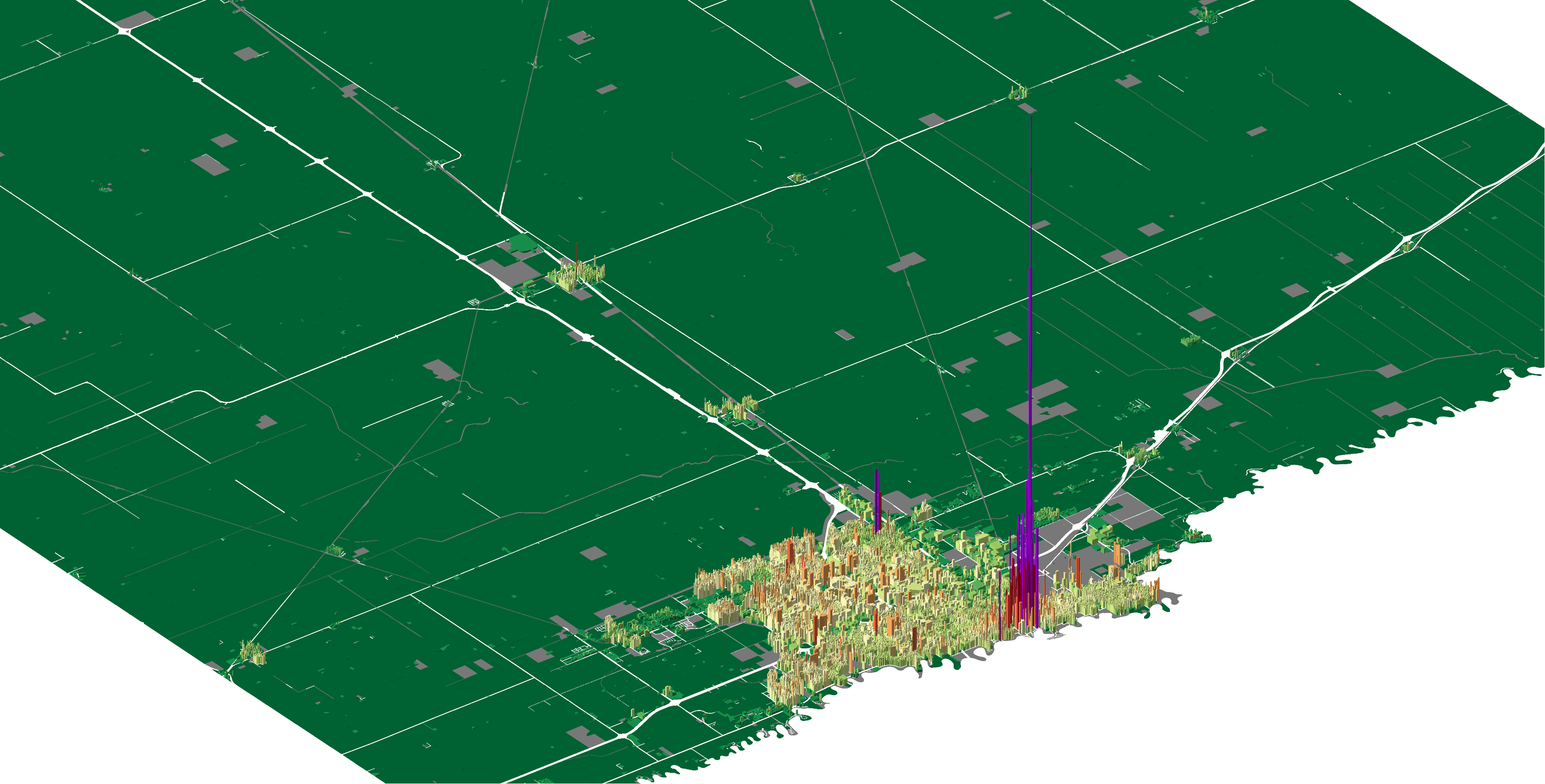
Cass County, ND
Fiscal Health + Land Use Development Analysis
As a geospatial analyst with Urban3, I contributed to a team that visualized the financial impact of different development types across Cass County, North Dakota, focusing on Fargo, Casselton, and Kindred. Using tools like ArcGIS Desktop, ArcScene, and ArcGIS Online, we created 3D models to assess how various land uses influenced municipal finances. Our findings were presented at the 2021 Main Street Summit, providing valuable insights to the North Dakota Department of Commerce to guide future urban planning and economic development efforts.
Project Description
Client
North Dakota Department of Commerce
Focus Area
Fargo, Casselton, & Kindred
Media
Video: 2021 Main Street Summit
Organization
Urban3
Role
Geospatial Analyst
Skills Used
ArcGIS Desktop, ArcScene, ArcGIS Online, ESRI Experience Builder, Apple Keynote
Year
2021

Experience Builder Application
-
This application has been developed to feature an interactive 3D model that illustrates the revenue per acre for different land uses within Cass County. Through user-friendly widgets, individuals can explore specific parcels of land and gain insights into the financial productivity associated with various land use scenarios.
-
This kind of application is beneficial for decision-makers who are interested in understanding the economic implications of various land use choices in Cass County. It is also a valuable educational tool for residents and students studying economics, urban planning, or land management.

Presentation Building
-
Video recording of Joe Minicozzi presenting fiscal health analysis results at the 2021 Main Street Summit in North Dakota.
-
The data visualizations created for Cass County, North Dakota, illustrated the financial impacts of diverse land uses on municipal budgets. Using ArcGIS Desktop, ArcScene, and ArcGIS Online, our team generated detailed 3D models that highlighted how development patterns in Fargo, Casselton, and Kindred influenced revenue and costs. These visualizations provided a clear, accessible comparison of the fiscal sustainability of different land uses